
New Arrival
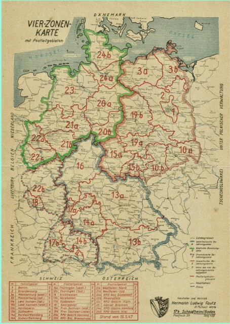
…from an antiquarian bookseller: it’s a 1947 map of Allied-occupied Germany, here emphasising the three-digit postal code system of the day.
The green-framed territory was under British, the blue under US control. In the southwest was French administration. The red-framed territory were Soviet-Russian occupied, to become the GDR in 1949.
The east-western border was still open in the year of print.
Note the poor paper quality used in those years, when almost all Europe suffered badly from the consequences of WW II.
Comments
Sign in or get an account to comment.


